First High-Resolution Lunar Map Released
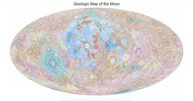
On April 21, China released the world's first high-resolution geological map of the Moon, compiled from data gathered during its Chang'e lunar exploration program.
Comprehensive Mapping
The set of maps includes a 1:2.5 million scale geological map of the entire Moon, a distribution map of lunar rock types, a tectonic outline map, and 30 sub-standard geological maps of the Moon.
Collaboration and Precision
Led by Academician Ouyang Ziyuan and Researcher Liu Jianzhong of the CAS Institute of Geochemistry, the maps were compiled in collaboration with scientists from universities and research institutes since 2012.
Outdated Previous Maps
According to Ouyang, lunar geological research currently relies on a map developed during the Apollo program with a scale of approximately 1:5 million. With the advancement of lunar exploration, particularly China's Chang'e program, the old map no longer meets the demands of future lunar scientific research.
Data and Interpretation
Liu Jianzhong explained that the new maps were drawn based on a comprehensive understanding of the origin and evolution of the Moon, data from the Chang'e exploration program, and existing domestic and international research.
Future Plans
Liu revealed that the team plans to produce higher-resolution geological maps of the Moon with a scale of 1:1 million in the next two years. They also propose compiling maps with scales of 1:10,000 and even 1:5000 for target areas, such as landing sites for future missions. Additionally, plans include creating a geological map of Mars to study its geological evolution.
